Reference library

Blog

Long-form assessment of technology and education. Every substantive claim links to a primary or authoritative source; every article ends with its reference list.

86 articles
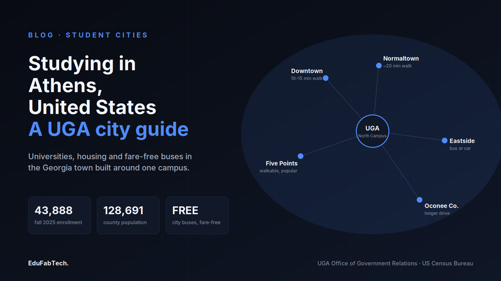
A map of Athens, Georgia radiating from UGA's North Campus to its student neighborhoods, with enrollment, population and fare-free-transit stats.
🏙️ Student Cities Explainer

Studying in Athens, United States: universities, housing and student life

What it is like to study and live in Athens, Georgia: the University of Georgia and Athens Technical College, where students live, how to r…

EduFabTech · 1h ago · 10 min read
A map-style overview of Eugene's student neighborhoods around the University of Oregon campus, with key stats on campus size, degree programs, and F-1 work hours.
🏙️ Student Cities Explainer

Studying in Eugene: universities, housing and student life

What it is actually like to study in Eugene, Oregon: the University of Oregon and the city's smaller colleges, neighbourhoods, housing cost…
EduFabTech · 4h ago · 10 min read
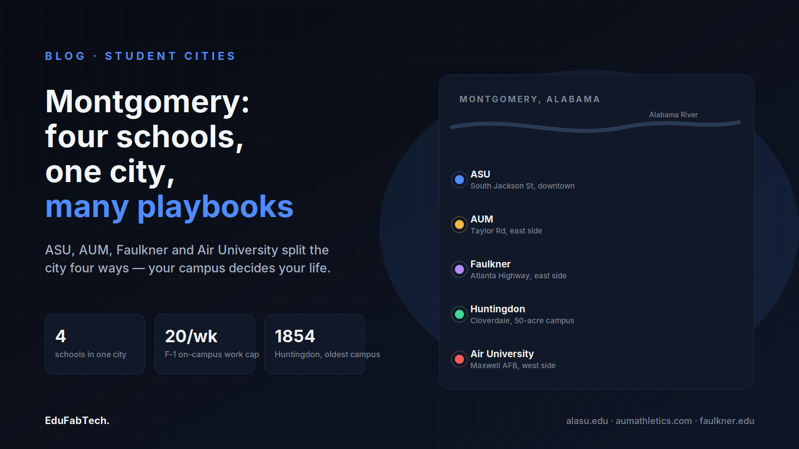
A schematic map of Montgomery marking all five campuses (ASU, AUM, Faulkner, Huntingdon, Air University) alongside the Alabama River, with stats on the number of schools, the F-1 work-hour cap, and Huntingdon's 1854 founding.
🏙️ Student Cities Explainer

Studying in Montgomery: universities, housing and student life

From Alabama State University and AUM to Faulkner and Air University, here is how Montgomery students find rooms, get around a car-shaped c…
EduFabTech · 6h ago · 11 min read
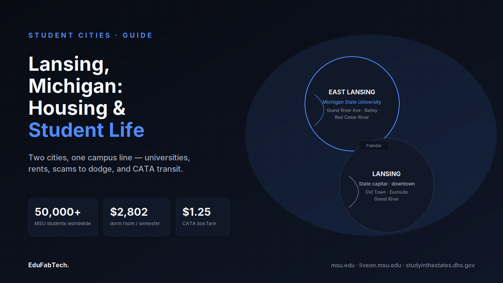
A split map-like diagram shows East Lansing (MSU, Grand River Ave, Red Cedar River) and Lansing (the capital, Old Town, Eastside) joined at Frandor, alongside stats on MSU enrollment, dorm cost and CATA fare.
🏙️ Student Cities Explainer

Studying in Lansing: universities, housing and student life

What it is like to study in Lansing and East Lansing: Michigan State and Great Lakes Christian College, where rooms turn up, dorm costs for…

EduFabTech · 8h ago · 10 min read
Syracuse University's hilltop campus and its headline stats — 22,000+ students, a 15:1 faculty ratio, and 64% of classes under 20.
🏙️ Student Cities Explainer

Studying in Syracuse: universities, housing and student life

Syracuse University sits on a hill above a small, snowy New York city. Here is where students live, what housing costs in 2026-27, how the …
EduFabTech · 11h ago · 10 min read
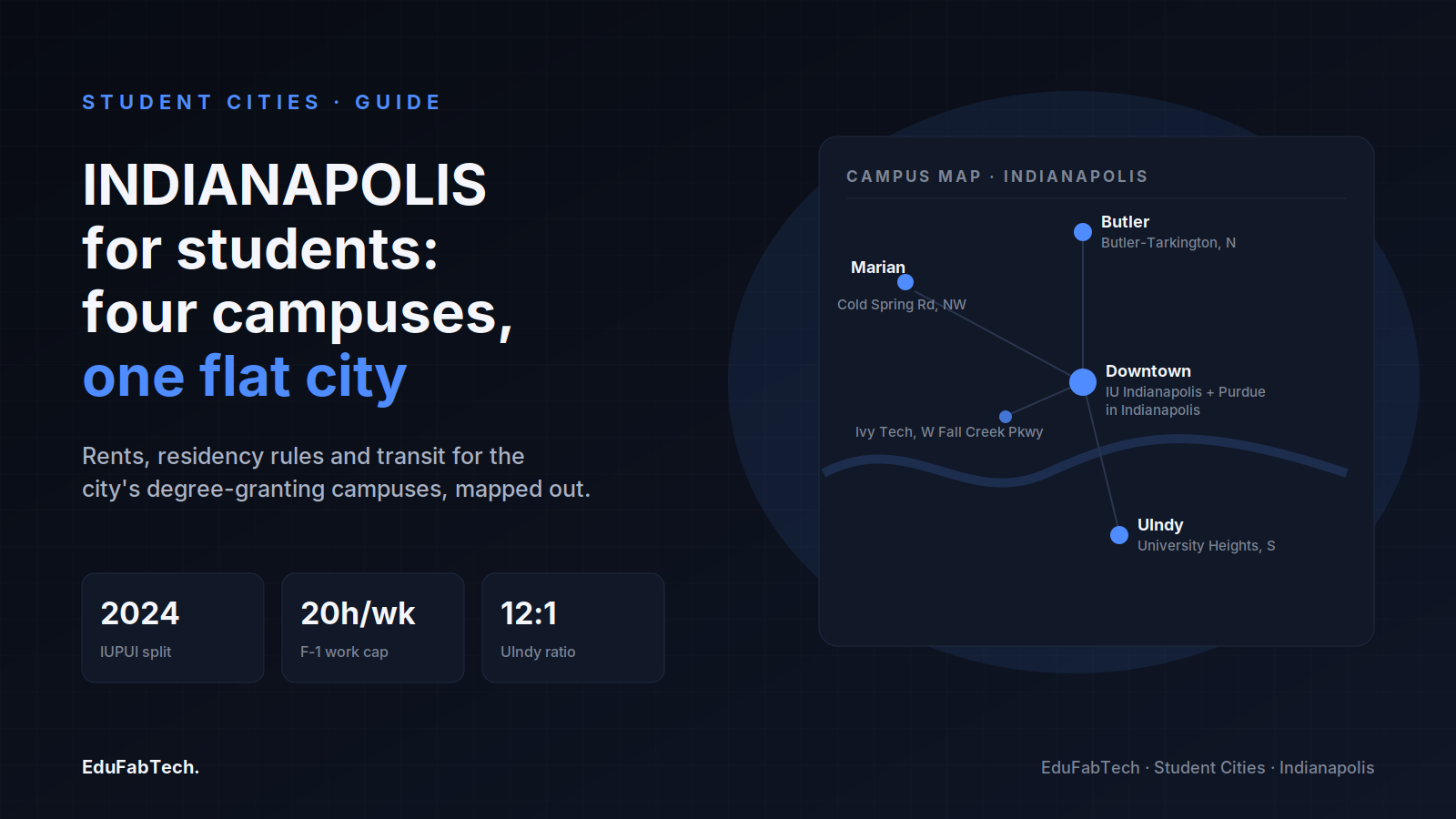
A mini map of Indianapolis locates Butler, Marian, the downtown IU Indianapolis/Purdue campus and UIndy, alongside key facts on the 2024 IUPUI split, the F-1 work-hour cap and UIndy's student-faculty ratio.
🏙️ Student Cities Explainer

Studying in Indianapolis: universities, housing and student life

Where students live in Indianapolis, how to rent without being scammed, what Butler and UIndy charge in 2026-2027, IndyGo fares, and the ho…

EduFabTech · 13h ago · 10 min read
A mountain-ringed "Happy Valley" diagram shows Penn State University Park's 42,822 residential undergrads and 86,557 system-wide students dwarfing the town of under 50,000 residents.
🏙️ Student Cities Explainer

Studying in State College: universities, housing and student life

What it is actually like to study in State College: the universities, where students live, furnishing a room cheaply, part-time work rules,…
EduFabTech · 17h ago · 11 min read
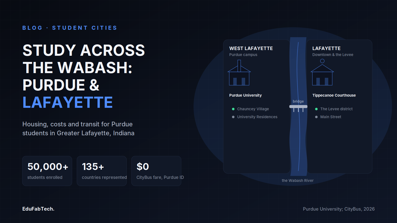
A schematic river map shows West Lafayette's Purdue campus and Lafayette's downtown linked by a pedestrian bridge over the Wabash, with headline stats on enrollment, international diversity and free student bus fare.
🏙️ Student Cities Explainer

Studying in Lafayette, United States: universities, housing and student life

What it is really like to study in Greater Lafayette, Indiana: Purdue's named colleges and schools, how to rent safely near campus, 2026-27…

EduFabTech · 19h ago · 9 min read
A stylized map of Baton Rouge showing Southern University to the north, the State Capitol downtown, and LSU to the south along the Mississippi, with enrollment and transit stats.
🏙️ Student Cities Explainer

Studying in Baton Rouge: universities, housing and student life

Baton Rouge has two big public universities on the Mississippi. Here is how students live there: neighbourhoods, dorm rates, renting safely…

EduFabTech · 21h ago · 9 min read
A loop-highway map of San Antonio pins the city's scattered campuses — UTSA, UIW & Trinity, St Mary's & OLLU, and Texas A&M-San Antonio — around downtown and the River Walk.
🏙️ Student Cities Explainer

Studying in San Antonio: universities, housing and student life

From UTSA's far north-west campus to the South Side and the West Side, a grounded look at housing, costs, transport and study spaces for st…

EduFabTech · 23h ago · 10 min read
A schematic map of Oʻahu's south shore locating the four campuses — UH–West Oʻahu in Kapolei, HPU downtown, UH Mānoa in the valley, and Chaminade on the Kaimukī ridge — alongside key stats on cost and work rules.
🏙️ Student Cities Explainer

Studying in Honolulu: universities, housing and student life

From UH Mānoa in Mānoa Valley to HPU on the downtown waterfront, here is how studying and living in Honolulu actually works — housing, cost…
EduFabTech · 1d ago · 10 min read
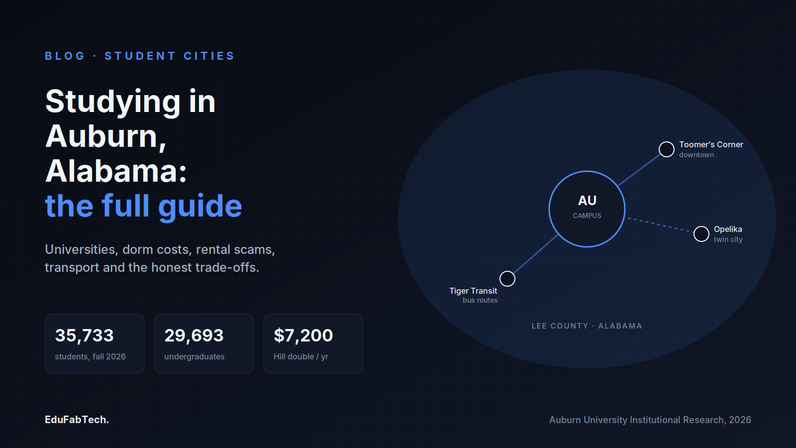
A town-map schematic linking Auburn University's campus, downtown Toomer's Corner, Tiger Transit and twin-city Opelika, with headline stats on fall 2026 enrollment and dorm cost.
🏙️ Student Cities Explainer

Studying in Auburn, United States: universities, housing and student life

What it is actually like to study and live in Auburn, Alabama: Auburn University and nearby Tuskegee, on-campus room rates for 2026-27, ren…

EduFabTech · 1d ago · 11 min read
Page 1 of 8 Next →